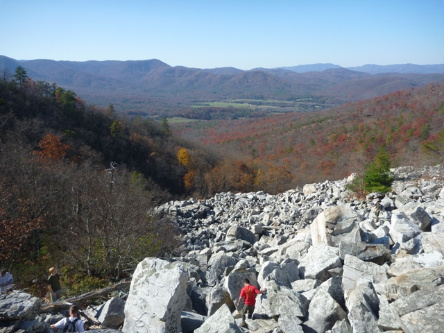
The Devil's Marbleyard is 8 acres of Antietam-Quartzite boulders. It is located in the James River Face Wilderness, near Glasgow, VA. The Marbleyard can be visited as part of a one-way hike to the James River (variation 1) or as a loop with the Gunter Ridge Trail (variation 2).
Variation 1
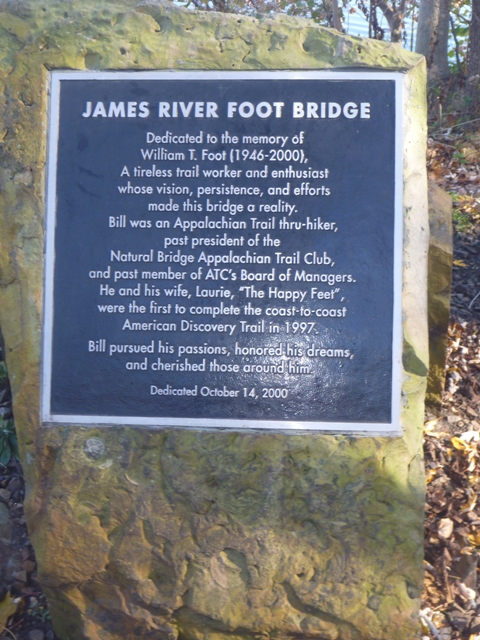
This hike makes a great one-night backpacking trip, but can easily be done in one day. If done as described, the first day is 6.0 miles and the second day is 2.2 miles. It works best with two vehicles. One vehicle should be parked at the end of the Appalachian Trail footbridge that crosses the James River by Route 501. This is southeast of Glasgow near Snowden, VA.
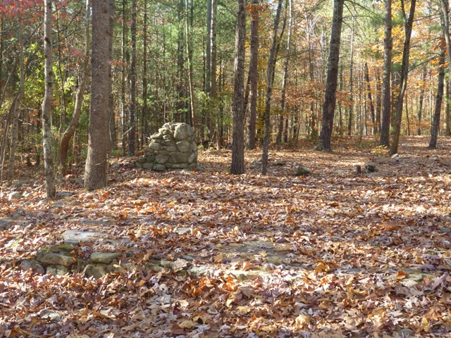
The hike starts at the trailhead for the Belfast Trail. It is located off Petites Gap Road (State Route 781) and has parking for about five cars. Take the Belfast trail northeast. The trail passes a turn-off for the Gunter Ridge Trail, but stay on the Belfast Trail. An old Boy Scout camp, Camp Powhatan, is near the beginning of the trail.
The Marbleyard will be on your right after about 1.4 miles. It offers great views and bouldering opportunities. Continue on the Belfast Trail to the AT (about another 1.4 miles). Go left (northbound) on the AT. Matts Creek Shelter will be about 3.2 miles up the trail. There are plenty of tent sites around the shelter. Water can be obtained from the creek.
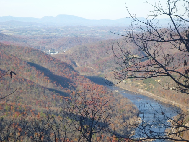
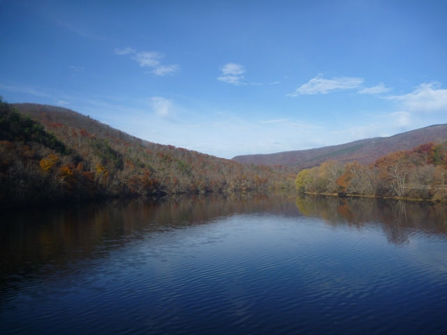
The hike out on Day 2 will provide great views of the James River. The occasional coal train will rumble by on the tracks beside the river. After descending to water level, cross the bridge to the parking lot where your second car is waiting.
Variation 2
This hike follows the same path as Variation 1 until the 2.4 mile mark. Turn left onto the Gunter Ridge Trail. This is between the Marbleyard and the AT. Follow the Gunter Ridge Trail west and then south until it runs into the Belfast Trail near the parking lot. Take the Belfast Trail back to your vehicle.
Notes
This is a wilderness area. Please limit your group size to 12 and follow all posted regulations.
The recommended map for this hike is the National Geographic Trails Illustrated map for Lexington/Blue Ridge Mountains (#789).
Variation 1
This hike makes a great one-night backpacking trip, but can easily be done in one day. If done as described, the first day is 6.0 miles and the second day is 2.2 miles. It works best with two vehicles. One vehicle should be parked at the end of the Appalachian Trail footbridge that crosses the James River by Route 501. This is southeast of Glasgow near Snowden, VA.
The hike starts at the trailhead for the Belfast Trail. It is located off Petites Gap Road (State Route 781) and has parking for about five cars. Take the Belfast trail northeast. The trail passes a turn-off for the Gunter Ridge Trail, but stay on the Belfast Trail. An old Boy Scout camp, Camp Powhatan, is near the beginning of the trail.
The Marbleyard will be on your right after about 1.4 miles. It offers great views and bouldering opportunities. Continue on the Belfast Trail to the AT (about another 1.4 miles). Go left (northbound) on the AT. Matts Creek Shelter will be about 3.2 miles up the trail. There are plenty of tent sites around the shelter. Water can be obtained from the creek.
The hike out on Day 2 will provide great views of the James River. The occasional coal train will rumble by on the tracks beside the river. After descending to water level, cross the bridge to the parking lot where your second car is waiting.
Variation 2
This hike follows the same path as Variation 1 until the 2.4 mile mark. Turn left onto the Gunter Ridge Trail. This is between the Marbleyard and the AT. Follow the Gunter Ridge Trail west and then south until it runs into the Belfast Trail near the parking lot. Take the Belfast Trail back to your vehicle.
Notes
This is a wilderness area. Please limit your group size to 12 and follow all posted regulations.
The recommended map for this hike is the National Geographic Trails Illustrated map for Lexington/Blue Ridge Mountains (#789).